Mapping out the building blocks of life – that’s essentially what biodiversity mapping projects led by academic teams are all about. Think of it as creating a detailed inventory of all the living things in a specific area, from the tiniest fungi to the largest mammals, and understanding where they live and how they interact. Why do academics bother with this? Because having this information is crucial for everything from protecting endangered species and managing natural resources sustainably to understanding how ecosystems are changing in the face of climate change and human activity. It’s the fundamental data that allows us to make informed decisions about the natural world around us.
It might seem like a lot of effort to catalog every plant and bug, but there are solid, practical reasons behind these academic endeavors. It’s not just about curiosity; it’s about providing the foundational knowledge for conservation and management.
Tracking What We Have
At its core, biodiversity mapping is about creating a baseline. Before you can protect something, you need to know that it exists, where it lives, and how many of it there are. This sounds simple, but in vast and complex ecosystems, it’s a significant undertaking.
- Species Inventories: Academic teams meticulously document the species present in a given region. This can involve field surveys, collecting specimens, and using sophisticated identification techniques.
- Population Estimates: Beyond just listing species, these projects often try to estimate population sizes. This helps identify species that might be rare or declining and require immediate attention.
- Genetic Diversity Assessment: Sometimes, the mapping goes deeper than just identifying species. Researchers might assess the genetic diversity within a population, which is vital for its long-term survival and ability to adapt to changing conditions.
Identifying Vulnerable Areas and Species
Not all parts of the natural world are created equal when it comes to biodiversity. Some areas might be incredibly rich in species, while others might be home to unique or endangered organisms. Mapping helps pinpoint these critical zones.
- Hotspot Identification: Researchers use mapping data to identify biodiversity hotspots – areas with a disproportionately high number of endemic species and significant threats.
- Endangered Species Distribution: Understanding where endangered or threatened species are found is paramount for targeted conservation efforts. Mapping data helps direct resources to protect their habitats.
- Habitat Connectivity: Mapping can also reveal how different habitats are connected, or disconnected. This is important for ensuring that wildlife can move freely, find food, and reproduce.
The “How”: Methods and Tools of Biodiversity Mapping
Academic biodiversity mapping isn’t usually done with just notebooks and binoculars anymore. Modern projects leverage a range of technologies and scientific approaches to gather and analyze data.
Traditional Fieldwork: The Foundation
Despite technological advancements, boots-on-the-ground fieldwork remains an indispensable part of biodiversity mapping. It provides the direct observation and data that fuel the more advanced techniques.
- Transect Surveys: Researchers walk along predefined lines (transects) and record all species encountered. This is a systematic way to sample an area.
- Quadrat Sampling: For plants and smaller organisms, researchers establish small, defined plots (quadrats) and meticulously count or identify everything within them.
- Specimen Collection: Collecting physical samples of plants, insects, or other organisms is crucial for accurate identification, taxonomic research, and preservation in herbaria or museums.
- Acoustic Monitoring: For elusive or nocturnal species, especially birds and amphibians, acoustic monitors can record their calls, allowing researchers to identify species and estimate their abundance based on sound.
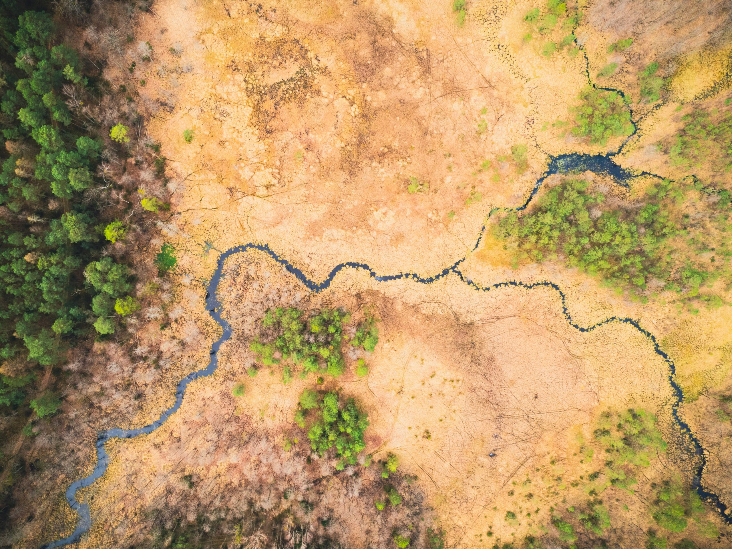
Remote Sensing and GIS: The Bigger Picture
Remote sensing technologies, like satellites and aerial drones, combined with Geographic Information Systems (GIS), allow for mapping biodiversity across much larger scales and with greater detail.
- Satellite Imagery Analysis: Different spectral bands in satellite imagery can reveal information about vegetation types, health, and land cover. This helps in mapping habitat distribution.
- LiDAR (Light Detection and Ranging): LiDAR uses laser pulses to create detailed 3D maps of terrain and vegetation structure. This is invaluable for mapping forest complexity and canopy cover.
- Drone-Based Mapping: Drones equipped with high-resolution cameras or specialized sensors can provide much more granular data than satellites, especially for surveying difficult-to-access areas or monitoring specific features.
- Geographic Information Systems (GIS): GIS is the backbone of modern spatial analysis. It integrates various data layers (species locations, habitat types, environmental factors) to create comprehensive biodiversity maps and conduct complex analyses.
Molecular and Genetic Techniques: Digging Deeper
Genetics and molecular biology are increasingly being integrated into biodiversity mapping, providing insights that traditional methods can’t easily capture.
- Environmental DNA (eDNA): While not strictly a “mapping” technique in the traditional sense, eDNA analysis from water or soil samples can detect the presence of species that are difficult to observe directly, contributing to a more complete species list within an area.
- DNA Barcoding: This technique uses short DNA sequences to identify species. It’s especially useful for difficult-to-identify organisms like insects or fungi.
- Population Genetics: Analyzing genetic variation within populations helps understand their connectivity, health, and adaptability, which can inform conservation strategies.
Challenges and Limitations in Biodiversity Mapping
While the science and technology are advancing, academic teams face significant hurdles when undertaking biodiversity mapping projects. These aren’t just occasional inconveniences; they are systemic challenges that can impact the scope and accuracy of the results.
Accessibility and Cost
Getting to remote locations and deploying advanced technologies isn’t cheap or easy. This often dictates the scale and duration of projects.
- Difficult Terrain: Many biodiversity-rich areas are in remote, mountainous, or dense jungle regions, making fieldwork physically demanding and time-consuming.
- Logistical Hurdles: Transport, accommodation, and field equipment all add to the cost and complexity of projects in isolated locations.
- Technological Investment: High-end equipment like LiDAR scanners, advanced drones, and reliable computational resources require substantial financial investment.
Data Gaps and Uncertainty
Even with the best efforts, there are always gaps in our knowledge. Nature is vast and constantly changing, making a complete picture nearly impossible to achieve.
- Cryptic Species: Many species are small, nocturnal, or live in habitats that are hard to access, making them difficult to find and identify.
- Seasonal Variation: Biodiversity can fluctuate significantly throughout the year, depending on breeding seasons, migration patterns, and plant life cycles. Mapping a single snapshot might miss crucial information.
- Observer Bias: The skill and experience of the field researchers can introduce an element of subjectivity or bias into the data collected.
- Taxonomic Expertise: Accurate identification of many species, particularly invertebrates and fungi, requires highly specialized taxonomic knowledge, which is a finite resource.
Data Management and Standardization
The sheer volume of data generated by these projects, combined with different methodologies, presents its own set of challenges.
- Data Storage and Processing: Storing and processing massive datasets, often including high-resolution imagery and genetic sequences, requires significant computational power and infrastructure.
- Standardization of Protocols: Different research teams might use slightly different sampling methods or identification keys, which can make it challenging to compare data across studies.
- Data Sharing and Accessibility: Ensuring that data is made easily accessible to other researchers and policymakers is crucial for its wider impact, but issues of ownership, format, and funding for long-term data archiving can be obstacles.
Applications and Impact of Biodiversity Mapping Data
The information gleaned from academic biodiversity mapping projects isn’t just for academic journals. It has tangible, practical applications that influence how we interact with and manage our planet.
Conservation Planning and Management
This is perhaps the most direct and impactful application of biodiversity mapping. It provides the evidence base for making conservation decisions.
- Protected Area Designation: Mapping helps identify areas that are most critical for biodiversity, guiding decisions on where to establish national parks, reserves, and other protected areas.
- Species Recovery Programs: Understanding the distribution and population status of endangered species is essential for designing effective recovery programs.
- Habitat Restoration Prioritization: Mapping can highlight degraded habitats that are most likely to benefit from restoration efforts, or areas that are crucial for connecting fragmented populations.
Environmental Impact Assessment and Policy
Before large-scale development projects commence, their potential impact on biodiversity needs to be understood. Biodiversity mapping plays a key role here.
- Informing Development Decisions: Mapping data helps developers and regulators understand what species and habitats are present in an area proposed for development, allowing for more informed decisions about mitigation strategies or alternative locations.
- Assessing Cumulative Impacts: By mapping biodiversity across broader regions, researchers can help assess the cumulative impact of multiple development projects or human activities on ecosystems.
- Developing Environmental Policy: The data from mapping projects provides scientific backing for environmental policies, regulations, and legislation aimed at protecting biodiversity.
Citizen Science and Public Engagement
While primarily led by academics, many biodiversity mapping projects incorporate or inspire citizen science initiatives, broadening their reach and impact.
- Engaging Local Communities: Projects can involve local communities in data collection, fostering a sense of ownership and responsibility for their local environment.
- Citizen Science Platforms: Tools like iNaturalist or eBird, while not exclusively academic projects, are built on a foundation of scientific principles and often collaborate with academic researchers, allowing the public to contribute valuable data.
- Raising Public Awareness: The visible outputs of mapping projects, like maps and reports, can help raise public awareness about the importance of biodiversity and the threats it faces.
Future Directions in Biodiversity Mapping
| Project Name | Location | Duration | Species Studied |
|---|---|---|---|
| Amazon Biodiversity Mapping | Amazon Rainforest, Brazil | 3 years | Various plant and animal species |
| Borneo Rainforest Biodiversity Project | Borneo, Malaysia | 5 years | Orangutans, pygmy elephants, various plant species |
| Great Barrier Reef Biodiversity Assessment | Queensland, Australia | 2 years | Coral species, fish species |
The field of biodiversity mapping is constantly evolving, driven by technological innovation, a deeper understanding of ecological processes, and the increasing urgency of conservation challenges.
Integration of AI and Machine Learning
Artificial intelligence is poised to revolutionize how biodiversity data is processed and interpreted.
- Automated Species Identification: Machine learning algorithms are being trained to identify species from images, audio recordings, and even sensor data, significantly speeding up the analysis process.
- Predictive Modeling: AI can help predict species distributions based on environmental factors, filling in data gaps and forecasting how species might respond to climate change.
- Pattern Recognition: AI can identify complex patterns in large datasets that might be missed by human observers, leading to new ecological insights.
Real-time and Continuous Monitoring
The goal is shifting from snapshot mapping to continuous, dynamic understanding of biodiversity.
- Sensor Networks: Deploying networks of environmental sensors that collect data on species presence, abundance, and environmental conditions in real-time.
- Automated Drone Surveys: Regular, automated drone flights over specific areas to monitor changes in vegetation, habitat structure, and even animal behavior.
- Integration with Other Data Streams: Combining biodiversity data with climate data, land-use changes, and social-economic data to create more holistic models of ecosystem health.
Citizen Science at Scale
The power of citizen science will likely continue to grow, becoming an even more integral part of mainstream biodiversity mapping.
- Standardized Citizen Science Protocols: Developing more robust and standardized protocols for citizen science data collection to increase its reliability and compatibility with academic research.
- Gamification and Engagement: Using gamified approaches and advanced mobile applications to encourage broader and more sustained public participation.
- Co-creation of Knowledge: Moving towards a model where researchers and citizen scientists collaborate more directly in the design and interpretation of mapping projects.
Focus on Functional Biodiversity
Beyond just species lists, there’s a growing emphasis on understanding the functional roles species play in ecosystems.
- Mapping Ecosystem Services: Identifying and mapping the services that ecosystems provide, such as pollination, water purification, and carbon sequestration, which are directly linked to biodiversity.
- Trait-Based Mapping: Mapping the distribution of species based on their functional traits (e.g., leaf size, dispersal ability, diet) to understand how these traits influence ecosystem processes.
- Network Analysis: Mapping the complex interactions between species (e.g., predator-prey relationships, plant-pollinator networks) to understand ecosystem stability and resilience.
FAQs
What are biodiversity mapping projects?
Biodiversity mapping projects are initiatives led by academic teams to systematically document and analyze the distribution and abundance of species within a specific area. These projects aim to provide valuable data for conservation efforts and ecological research.
How do academic teams lead biodiversity mapping projects?
Academic teams lead biodiversity mapping projects by conducting field surveys, utilizing remote sensing technologies, and analyzing existing data to create comprehensive maps of species distribution. They often collaborate with local communities and other stakeholders to gather information and ensure the accuracy of the mapping efforts.
What are the benefits of biodiversity mapping projects led by academic teams?
Biodiversity mapping projects led by academic teams provide valuable insights into the ecological health of a region, help identify areas of high conservation priority, and contribute to the development of effective conservation strategies. These projects also offer opportunities for student involvement and capacity building within the academic community.
How do biodiversity mapping projects contribute to conservation efforts?
Biodiversity mapping projects contribute to conservation efforts by providing essential data for identifying and protecting critical habitats, monitoring changes in species distribution, and informing land use planning and management decisions. This information is crucial for preserving biodiversity and mitigating the impacts of human activities on natural ecosystems.
What are some examples of successful biodiversity mapping projects led by academic teams?
Examples of successful biodiversity mapping projects led by academic teams include the BioMap project in the United States, the BioBlitz events organized by various universities, and the Global Biodiversity Information Facility (GBIF) network, which facilitates the sharing of biodiversity data among academic institutions worldwide. These projects have significantly contributed to our understanding of biodiversity and have informed conservation actions on a global scale.